


Room 55841, 8th Floor, Computer Network Center
Rey-Jer You

| Email: | rjyou@mail.ncku.edu.tw |
|---|---|
| Email2: | rjyou01@gmail.com |
| Telephone: | 06-2757575 ext.63821 |
| Fax: | 06-2375764 |
| Office: |
|
| Education: |
Dr.-Ing., Institute of Geodetic Science, University of Stuttgart, Germany B.S., Department of Surveying Engineering, National Cheng Kung University M.S., Institute of Aeronautical Photogrammetry, National Cheng Kung University |
| Experience: |
Dr.-Ing., Institute of Geodetic Science, University of Stuttgart, Germany, 1995 Associate Professor, Department of Geomatics, National Cheng Kung University, 1995–2012 Teaching Assistant, Department of Surveying Engineering, National Cheng Kung University, 1986–1988 Chair, Commission 5, Sub-Commission 1, Section IV, International Association of Geodesy (IAG), 1995–1999 Member, National Fundamental Control Survey Promotion Task Force, Ministry of the Interior, 1998–2005 Member, National Committee of the International Union of Geodesy and Geophysics (IUGG), Republic of China, 2000–2011 Member, Subcommittee 3, Task Force for Improvement of Professional Engineer Examinations, Ministry of Examination, 2010–2011 Member, Review Committee for Civil Engineering Professional Engineer Examination, Ministry of Examination, 2011–2012 Member, Review Committee for Civil Engineering Professional Engineer Examination, Ministry of Examination, 2017–Present |
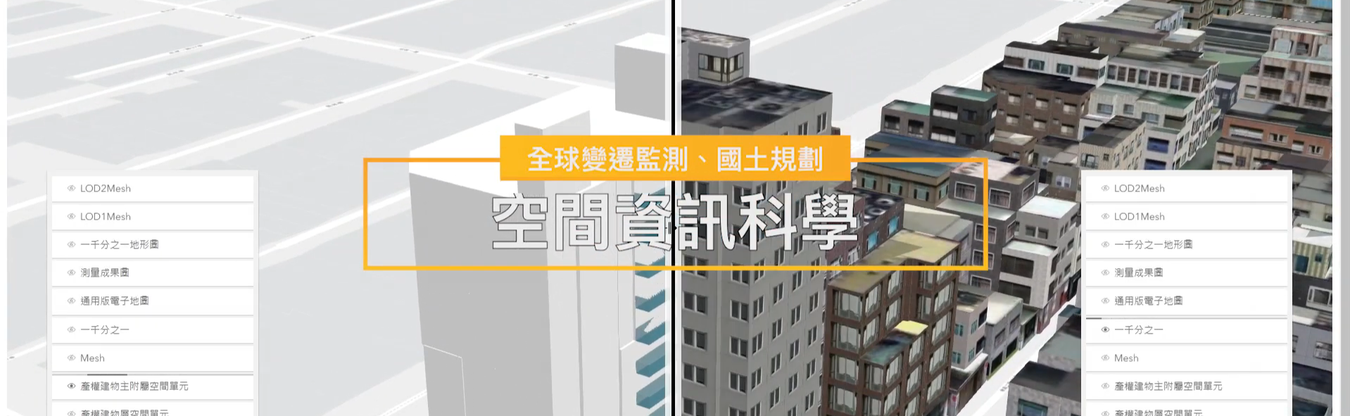
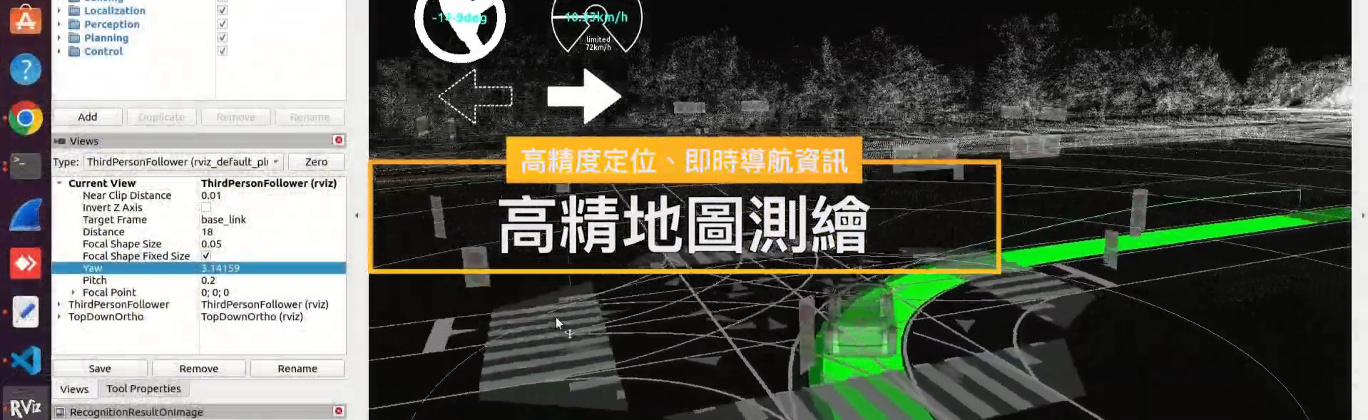
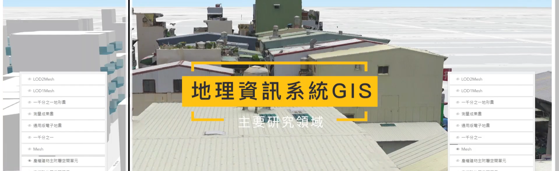
| Expertise: | Geomatics Engineering, Geodesy, Satellite Geodesy, Lidar, Theroy of Errors, Statistical Adjustment, Quality analysis of Geomatical and Geospatial data |
| Course: |
Currently Taught:Surveying、Engineering Statistics、Theory of Errors Previously Taught:Geodesy、Physical Geodesy、Survey Coordinate Systems、Advanced Satellite Geodesy、Statistical Adjustment、Engineering Mathematics |
Introduction:
Books, Software, and Master’s/Doctoral Theses
- 尤瑞哲 (1985 - ): Collocation 坐標轉換軟體 (Software)
- 尤瑞哲 (2005 - ): GPS-Heighting 軟體 (Software)
- 尤瑞哲等11名作者著(2024): 現代測量學 (Modern Geomatics)。ISBN 786269855575,滄海書局,台中。
- 尤瑞哲(2019): 基礎測量平差法 (Fundamentals of Least Squares Adjustment)。ISBN 9789863630777,滄海書局,台中。2021.06 勘誤表
- 尤瑞哲(2019): 進階測量平差法 (Advanced Least Squares Adjustment), ISBN 9789863630791,滄海書局,台中。2019.01版勘誤表
- 尤瑞哲(2011): 測量及空間資訊坐標系統與轉換 (Coordinate systems and its transformations for Geomatics and Geo-spatial Information),ISBN 978-957-41-8374-6,414頁。國立成功大學測量及空間資訊學系,台南
- Grafarend, E.W., You, R.J. and Syffus, R. (2014): Map projections for Cartographic Information Systems (地圖投影專書). 2nd. Edition, 2 Volumes, ISBN 978-3-642-36493-8, Springer Verlag, Berlin
- You, R.J. (1995): Zur analytischen Bahnberechnung-kuensflicher Erdsatelliten mittels konformer Transformationen. Ph.D. Dissertation, Universitaet Stuttgart, Deutschland, DGK C440, Muenchen。ISSN 0065-5325, ISBN 3-7696-9483-X (Ph.D. dissertation, Stuttgart University, Germany. English translation: Analytical Computation of Earth artificial satelite's orbits by conformal transformations. 德國司徒加特大學博士論文:利用正形投影轉換法解析計算地球人造衛星軌道)
- You, R.J. (1990): Berechnung einer J2-gestoerten Satellitenbahn. Diplom Arbeit des Geodaetischen Institut der Universitaet Stuttgart. (M.Sc. thesis of Stuttgart University. English translation: Computation of a J2-perturbed satellite orbit. 德國司徒加特大學碩士論文: J2 -擾動的人造衛星軌道計算)
- 尤瑞哲(1984): 台灣三角網精度之檢討。國立成功大學航測研究所 碩士論文。 MSc. Thesis, Institute of Photogrammetry, National Cheng Kung University.
Journal Papers
- You, R.J. and Lee, C.-L. (2020): Accuracy improvement of airborne Lidar strip adjustment by using height data and surface Feature strength information derived from the tensor voting algorithm. ISPRS International Journal of Geo-Information, 9, 50; doi:10.3390/ijgi9010050.
- Hsu, Y.-J. Lai, Y.-R., You, R.-J. Chen, H.-Y., Teng, S.L. Tsai, Y., Tang, C.-H., and Su, H.H. Su (2018): Detecting rock uplift across southern Taiwan mountain belt by integrated GPS and leveling data.doi.org/10.1016/j.tecto.2018.07.012,Tectonophysics,744(2018) 275-284.
- Imani, M., Chen Y.-C., You,R.J., Lan, W.-H., Kuo, C.Y., Chang, J.C., and Rateb, A. (2017): Spatiotemporal Prediction of Satellite Altimetry Sea Level Anomalies in the Tropical Pacific Ocean. IEEE GEOSCIENCE AND REMOTE SENSING LETTERS, VOL. 14, NO. 7: 1126-1130.
- Imani, M., You, R.J. * and Kuo, C.Y. (2016): Prediction of Caspian Sea Level Fluctuations Using Artificial Intelligence. In Srivastava, P. K. (2016): "Geospatial Technology for Water Resource Development", Chapter 15. 978-1498719681, CRC Press, Taylor and Francis, USA.
- Keller, W. and You, R.J. (2015): Rosborough approach for the determination of regional time variability of the gravity field from satellite gradiometry data. International Journal on Geomathematics 6: 295-318 (11/ 2015). MOST 104-2911-1-006-518 .
- Grafarend, E.W. and You, R.J. (2015): Fourth order Taylor-Kármán structured covariance tensor for gravity gradient predictions by means of the Hankel transformation. International Journal on Geomathematics 6: 319-342 (11/ 2015). MOST 102- 2911-I-006-507, 104-2911- I-006-518.
- Keller, W. and You, R.J. (2014): Adaptation of the torus and Rosborough approach to radial base functions. Studia Geophysica et Geodaetica, Volume 58, Issue 2, pp 249-268.
- You, R.J. and Ko, C.H. (2014); Optimal scale factor on the central meridian for a 2oTM map Projection in TWD97. Journal of the Chinese Institute of Engineers, Vol. 37, No. 1, pp.103-109, DOI:10.1080/02533839.2012.751335. (NSC 99-2221-E-006-182)
- Imani, M., You, R.J., and Kuo, C.Y. (2014): Forecasting Caspian Sea level changed using satellite altimetry data (June 1992-December 2013) based on evolutionary support vector regression algorithms and gene expression programming. Global and Planetary Change 121, pp 53-63. (NSC 102-2221-E-006-234)
- Imani, M., You, R.J., and Kuo, C.Y. (2014): Caspian Sea Level Prediction Using Satellite Altimetry by Artificial Neural Networks, International Journal of Environmental Science and Technology, Volume 11, Issue 4, pp 1035-1042. DOI: 10.1007/s13762-013-0287-z. (NSC 100-2221-E-006-234, NSC 101-2221-E-006-183)
- Imani, M., You, R.J., and Kuo, C.Y. (2014): Analysis and Prediction of Caspian Sea Level pattern Anomalies Observed by Satellite Altimetry Using Autoregressive Integrated Moving Average Models. Arabian Journal of Geosciences, 7, Issue 8, pp. 3339-3348. DOI: 10.1007/s12517- 013-1048-5. (NSC 102-2221-E-006-234)
- Imani, M., You, R.J., Kuo, C.Y. (2013): Accurate Forecasting of Satellite-derived Seasonal Caspian Sea Level Anomaly Using Polynomial Interpolation and Holt-Winters Exponential Smoothing. Terrestrial Atmospheric and Oceanic Science, Vol. 24, No. 4, Part I, 521-530, DOI:10.3319/TAO.2012.10.12.01(TibXS). (NSC 100-2221-E- 006-234)
- You, R.J. and Lin, B.C. (2011): A Quality Prediction Method for Building Model Reconstruction using LiDAR Data and Topographic Map. IEEE Transactions on Geoscience and Remote Sensing Vol. 49 (9) PP 3471-3480 (NSC 98-2221-E-006-218, NSC 99-2221-E-006-182)
- You, R.J. and Lin, B. C. (2011): Building feature extraction from airborne Lidar data based on tensor voting algorithm. Photogrammetric Engineering and Remote Sensing, Vol. 77 (12) 1221-1231. NSC 95-2221-E006-337, NSC 98-2221-E-006-218, NSC 99-2221-E-006-182.
- You, R.J. and Wang, W.L. (2009): Automatic planar feature matching for adjustment of Lidar strips. J. Photogr. & Remote Sensing, Vol 14, No.3, pp. 185-199. (in Chinese)
- You, R.J. and Yang, M. J. (2008): Influence of local ionospheric model on GPS positioning --- A case study of Taiwan’s GPS tracking data over 2004. J. Chinese Society of Engineering Surveying, Vol. 50, No., 12, pp. 19-36. (in Chinese)
- You, R. J. (2006): Local Geoid Improvement Using GPS and Leveling Data: Case Study. ASCE J. Surv. Eng. Vol. 132, N0, 3, pp. 101-107.
- You, R.J. and Hwang, H.W. (2006):Coordinate Transformation between Two geodetic Datums of Taiwan by Least Squares Collocation. ASCE J. Surv. Eng. Vol. 132, N0, 2, pp. 64-70.
- You, R.J., Lee, C.H. and Lin, B.C. (2006): Airborne Lidar data filtering using robust prediction method. J. Chinese Society of Engineering Surveying, Vol. 48, No. 1&2, pp. 63-80. (in Chinese)
- You, R.J. and Lee, C.L. (2005): Application of the Common Subsequence Algorithms on the Automatic Detection of Building Boundaries by Integrating Image Features and LiDAR Point Clouds. J. Chinese Society of Engineering Surveying, Vol. 47, No. 4, pp. 21-34. (in Chinese)
Conference Papers
- 尤瑞哲 (2020):應用線性七參數相似轉換於車載製圖系統空中三角平差之研究。TGIS 2020, Dec. 10-11, 台南。
- Lin, S.-W. and You, R.-J. (2018): Positioning accuracy improvement of terrestrial mobile mapping systems using a bundle block adjustment. The 39th ACRS, 2018.10.15-10.19, Kuala Lumpur, Malaysia.
- Tsai, T.-Z. and You, R.-J. (2018) Linear solution of overdetermined seven-parameter transformation. The 39th ACRS, 2018.10.15-10.19, Kuala Lumpur, Malaysia.
- Jhou, C.-Y., Lin, S.-W., You, R. J. (2018): Positioning Improvement of Mobile Mapping System by Bundle Adjustment and Shadow Matching. International Symposium on Remote Sensing 2018, 9 – 11 May 2018, Alpensia Convention Center, Pyeongchang, Korea.
- Lia, Y.-R., Hsu, Y.-J., You, R.-J. (2017): Integrating Continuous GPS Time Series and Geodetic Leveling Data to Estimate Secular Vertical Velocity of Taiwan. American Geophysical Union (AGU) Fall Meeting, 11-15 Dec. 2017, New Orleans, Louisiana.
- You, R.J. and Kao, W.N. (2015): GOCE gravity gradient predictions by Taylor-Marman structured covariance tensor. ACRS 2015 The 36th Asian Conference on Remote Sensing 10.19. - 10.23 2015, Manila, Philippines. MOST 102-2221-E-006-234.
- Liu, Z.F. , Pan, L.W. and You, R.J. (2015): Determination of Earth’s gravity field by Torus and Rosborough approaches. (in Chinese) The 34th Survey and Geographical Information Research Conference, August. 27-28,2015, National Ilan University, Ilan. (MOST 103-2221-E-006-169)
- Yan, H. and You, R.J. (2015) A method to solve the multicollinearity problems. (in Chinese) The 34th Survey and Geographical Information Research Conference, August. 27-28,2015, Nation al Ilan University, Ilan. (MOST 103-2221-E-006-169)
- Huang, W.C., Lin, Y.T. and You, R.J (2015) Shadow matching algorithm and VRS-RTK technique for mobile positioning. (in Chinese) The 34th Survey and Geographical Information Research Conference, August. 27-28,2015, Nation al Ilan University, Ilan.
- Ko, C.H. and You, R.J. (2015) A study of optimal scale factor on a 2oTM map in TWD97. (in Chinese) The 34th Survey and Geographical Information Research Conference, August. 27-28,2015, Nation al Ilan University, Ilan.
- Lia, Y.-R., Wang, T.-T., Huang, T.H., You, R.-J. (2015): Multi-scale and Temporal-stage Integrated Survey Technology for Site Displacement and Deformation Monitoring in Geotechnical Engineering. The 26th General Assembly of the International Union of Geodesy and Geophysics (IUGG), 22 June – 2 July 2015, Prague, Czech Republic.
- Imani, M, You, R.J. and C.Y. Kao (2013): Prediction lake level variations using satellite observations in Caspain Sea: Case study. The 34th Asian Conference on Remote Sensing. 20-24 October, 2013, Bali, Indonesia.
- Grafarend, E.W. and You, R.J. (2013): The Geometry of the Kepler orbit/perturbed Kepler orbit/ in Maupertuis manifold by minimizing the scalar of Riemann Curvature tensor, aspect of the Kustaanheimo-Stiefel elements in Satellite Geodesy. The General Assembly 2013 of the European Geosciences Union to be held in Vienna, Austria, 07-12 April 2013.
- You, R.J. and Lin, B. C. (2012): Residual Tensor Analysis for Quality Assessment of Data Integration. The 33th Asian Conference on Remote Sensing. 26-30 November, 2012, Pattaya, Thailand.
- Lin, B.C. and You, R.J. (2012): Tensor-Based quality prediction for building model reconstruction from LiDAR data and topographic map. The XXII Congress of the International Society for Photogrammetry and remote Sensing, VII/7: Theory and Experiments in Radar and Lidar, 25 Aug. - 1 Sept, 2012, Melbourne, Australia.
- Hsu, M.C and You, R.J. (2012): Map-aided GPS/INS Navigation with DEM Data. (英文) 測量及空間資訊學術研討會,Sept. 27-28,2012,中國文化大學,台北。
- Imani, M., You, R. J., Kuo, C.-Y., and Ardalan, A. (2011): Sea level variations at southern part of Caspian sea as one of the effective factors in environmental damage at coastal areas of Iran. International Conference on Environmental Quality Concern, Control and Conservation, May 20-21, 2011, Kaohsiung, Taiwan ROC.
- Lin, B.C., You, R.J. M.C., Shu, M.C. (2010): Building model reconstruction with LiDAR data and topographic map by registration of building outlines. ISPRS 1910-2010 Centenary Celebration, July 2-7, 2010, Vienna, Austria.
- 尤瑞哲和王蜀嘉 (2012): 從理論和實務的觀點檢討一千分之一數值地形圖成果檢查作業規定。第31屆測量及空間資訊研討會,Sept. 27-28,2012,中國文化大學,台北。
- Lee, C.L. and You, R.J. (2010): Applications of Surface Feature Strength for Lidar Calibration. 兩岸非常規攝影測量研討會論文集,第212-220 頁,國立成功大學,台南。
- 林柏丞、尤瑞哲 (2010): 融合光達與地形圖資料重建三維建物模型。兩岸非常規攝影測量研討會論文集,第201-211 頁,國立成功大學,台南。李亞蒨,尤瑞哲,李昭諒 (2010): 應用掃描線演算法於光達平面特徵萃取。第29屆測量及空間資訊研討會,Sept. 2-3,2010,國立台北大學,台北
- 林柏丞、尤瑞哲、洪榮宏、廖向芃、柯承宏 (2010): 整合型地籍資料處理系統之開發。第29屆測量及空間資訊研討會論文集,Sept. 2-3,2010,國立台北大學,台北
Research Projects and Industry–Academia Collaboration Projects
-
Study on Applying the Linear Seven-Parameter Similarity Transformation to Aerial Triangulation Adjustment in Vehicle-Borne Mapping Systems (MOST 108-2621-M-006-004)
-
Research on Improving the Positioning Accuracy of Vehicle-Based Mobile Mapping Systems (MOST 105-2119-M-006-034)
-
Study on Local Gravity Field Determination Using Spherical Wavelet Functions with the Torus and Rosborough Methods (MOST 103-2221-E-006-169)
-
Study on Correlation Models of Multidimensional Vector Fields and the Application of Variance–Covariance Tensors in Geomatics (II) (NSC 102-2221-E-006-234)
-
Study on Correlation Models of Multidimensional Vector Fields and the Application of Variance–Covariance Tensors in Geomatics (I) (NSC 101-2221-E-006-183)
-
GPS/INS Positioning and Orientation with the Integration of Ground-Based Aiding Data (II) (NSC 100-2221-E-006-234)
-
GPS/INS Positioning and Orientation with the Integration of Ground-Based Aiding Data (I) (NSC 99-2221-E-006-182)
-
Integration of LiDAR and Image Data for Building Reconstruction and Quality Analysis (NSC 98-2221-E-006-218)
-
Adjustment Models Integrating LiDAR Data and Aerial Images and Their Applications (II) (NSC 97-2221-E-006-207)
-
Adjustment Models Integrating LiDAR Data and Aerial Images and Their Applications (I) (NSC 96-2221-E-006-149)
-
Application of the Tensor Voting Algorithm to Geometric Feature Extraction from LiDAR Point Clouds (NSC 95-2221-E-006-337)
-
Implementation of Open GML Standards for Water Resources Geographic Information (Water Resources Agency, Ministry of Economic Affairs), 2012
-
Development of a Value-Added Service Management System for Cadastral Data in the National Land Information System (National Land Surveying and Mapping Center, Ministry of the Interior), 2009
-
Phase II Planning and Implementation of Data Circulation and Sharing Standards for the National Land Information System (Year 2) (Ministry of the Interior), 2010
-
Commissioned Supervision Project for the Phase I Public Facility Pipeline Survey and System Construction, Tainan County (Tainan County Government), 2010
-
Commissioned Supervision Project for the Phase II Public Facility Pipeline Survey and System Construction, Kaohsiung County (Kaohsiung County Government), 2010
-
Commissioned Supervision Project for the Phase III Public Facility Pipeline Survey and System Construction, Tainan City (Tainan City Government), 2013
-
Commissioned Supervision and Inspection Project for the 2014 Public Facility Pipeline Data Survey and System Update and Expansion, Taichung City Government, 2014
-
Commissioned Supervision Project for the Phase IV Public Facility Pipeline Survey and System Construction, Tainan City (Tainan City Government), 2014
-
Commissioned Supervision Project for the Phase III Public Facility Pipeline Survey and System Construction, Chiayi County (Chiayi County Government), 2014
-
Commissioned Supervision Project for the Phase V Public Facility Pipeline Survey and System Construction, Tainan City (Tainan City Government), 2015
-
Commissioned Supervision Project for the Phase IV Public Facility Pipeline Survey and System Construction, Taitung County (Taitung County Government), 2015
-
Commissioned Supervision Project for the Phase III Public Facility Pipeline Survey and System Construction (FY 104), Chiayi County (Chiayi County Government), 2015
-
Commissioned Supervision Project for the Phase VI Public Facility Pipeline Survey and System Construction, Tainan City (Tainan City Government), 2016
-
Commissioned Supervision and Inspection Project for the Phase V Public Facility Pipeline Data Survey and System Update and Expansion, Taichung City Government, 2017
-
Commissioned Supervision Project for the Phase VII Public Facility Pipeline Survey and System Construction, Tainan City (Tainan City Government), 2017
-
Commissioned Supervision Project for the Phase VIII Public Facility Pipeline Survey and System Construction, Kaohsiung City (Kaohsiung City Government), 2017
-
Commissioned Supervision and Inspection Project for the Phase VI Public Facility Pipeline Data Survey and System Update and Expansion, Taichung City Government, 2018
-
Commissioned Supervision Project for the Phase IX Public Facility Pipeline Survey and System Construction, Tainan City (Tainan City Government), 2019
-
Commissioned Supervision Project for the Phase X Public Facility Pipeline Survey and System Construction, Kaohsiung City (Kaohsiung City Government), 2019
-
Commissioned Supervision Project for the Phase X Public Facility Pipeline Survey and System Construction, Tainan City (Tainan City Government), 2020
-
Commissioned Supervision Project for the Phase XI Public Facility Pipeline Survey and System Construction, Kaohsiung City (Kaohsiung City Government), 2020
-
Commissioned Supervision Project for the Phase XI Public Facility Pipeline Survey and System Construction, Tainan City (Tainan City Government), 2021
-
Commissioned Supervision Project for the Phase XII Public Facility Pipeline Survey and System Construction, Kaohsiung City (Kaohsiung City Government), 2021
-
Surveying Operation Guidelines for Expressways (Sinotech Engineering Consultants, Inc.), 2020
Click Num: