


李啓民

Email:cmlee@gs.ncku.edu.tw
電話:06-2757575 ext.63828
傳真:06-2375764
辦公室/研究室:55304
學歷:2019/09-2025/06 國立成功大學 測量及空間資訊學系 博士
2015/09-2017/06 國立成功大學 測量及空間資訊學系 碩士
2011/09-2015/06 國立成功大學 測量及空間資訊學系 學士
經歷:2026/02-迄今 國立成功大學 測量及空間資訊學系 專任助理教授
2025/06-2026/01 日本九州大學 應用力學研究所 博士後研究員
2023/09-2024/09 美國俄亥俄州立大學 地球科學系 訪問學者
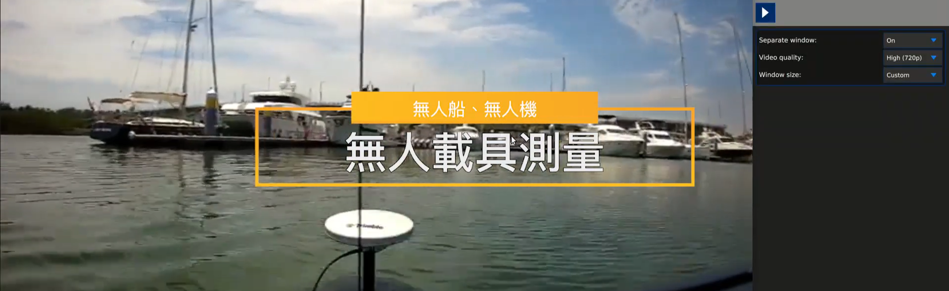
專長:GNSS反射技術(GNSS-R/GNSS-IR)、多音束測深(Multibeam Bathymetric Surveying)、海洋測繪(Marine Geomatics)、無人船(Unmanned Surface Vehicle)、大地測量(Geodesy)
授課項目:
學術成大
Google Scholar
著作目錄:
-
Shih, T. Y., Lin, Y. N., Lee, C. M., Kuo, C. Y., Chen, Y. T. (2025). Site Selection and Testing of the GNSS-Reflectometry Interferometric Tide Gauge Station in Lieyu. Journal of Cadastral Survey, 44(1), 1-14. (In Chinese)
- Shih, T. Y., Lee, C. M., Kuo, C. Y., Chen, Y. T. (2025). On the Data Processing of Sea Level Height using GNSS-IR: A Case Study at LIEY Station. Journal of Cadastral Survey, 44(1), 15-32. (In Chinese)
- Kuo, C. Y., Lan, W. H., Lee, C. M., & Kao, H. C. (2025). Evaluating the Potential of Sea Surface Height Observations and Depth Datum Calculation Using GNSS/IMU Buoys. Journal of Marine Science and Engineering, 13(1), 110. (SCI, IF=2.8, ENGINEERING, MARINE, 7/25, Q2) (link)
- Lan, W. H., Lee, C. M., Kuo, C. Y. (2025). Accuracy evaluation of depth datum and system for Taiwan using multi-data. Taiwan Journal of Geoinformatics, 13(1), 1-18. (ACI, In Chinese)
- Lee, C. M., Kuo, C. Y., Tu, H. H., Liu, T. Y. (2024). Bathymetric Modeling of Agricultural Irrigation Ponds Using an Unmanned Surface Vehicle with a Multi-Beam Echo Sounder. Journal of Chinese Soil and Water Conservation, 55(4), 179-185. (ACI, Scopes, In Chinese). (*First Author)
- Lan, W. H., Lee, C. M., Kuo, C. Y., Lin, L. C., & Handoko, E. Y. (2024). Regional sea level budget around Taiwan and Philippines over 2002‒2021 inferred from GRACE, altimetry, and in-situ hydrographic data. Journal of Geodesy, 99(1), 5. (SCI, IF=4.0, GEOCHEMISTRY & GEOPHYSICS, 13/100, Q1) (link)
- Lee, C. M., Fu, C. Y., Lan, W. H., & Kuo, C. Y. (2024). Performance evaluation of different reflected signal extraction methods on GNSS-R derived sea level heights. Advances in Space Research, 74(1), 89-104. (SCI, IF=2.8, ENGINEERING, AEROSPACE, 12/55, Q1).(link) (*First Author)
- Shih, H. C., Lee, C. M., Ho, M. K., Kuo, C. Y., Liao, T. S., Chen, C. P., Yeh, T. K. (2024). Monitoring and risk assessment of Taoyuan ponds using an unmanned surface vehicle with multibeam echo sounder, ground-penetrating radar, and electrical resistivity tomography. Geomatics, Natural Hazards and Risk, 15(1), 2323598. (SCI, IF=4.6, GEOSCIENCES, MULTIDISCIPLINARY, 34/258, Q1).(link)
- Lee, C. M., Kuo, C. Y., Yang, C. H., Kao, H. C., Tseng, K. H., & Lan, W. H. (2022). Assessment of hydrological changes in inland water body using satellite altimetry and Landsat imagery: A case study on Tsengwen Reservoir. Journal of Hydrology: Regional Studies, 44, 101227. (SCI, IF=5.0, WATER RESOURCES, 18/131, Q1).(link) (*First Author)
- Chiang, K.W., Wang, C. K, Kuo, C.Y., Li, P.L., Lin, C. H., & Lee, C. M. (2021). Verification, Validation, and Updating of HD Maps. Civil and Hydraulic Engineering, 48(5), 21-29. (ACI, In Chinese).
- Imani, M., Kuo, C. Y., Chen, P. C., Tseng, K. H., Kao, H. C., Lee, C. M., & Lan, W. H. (2021). Risk assessment of coastal flooding under different inundation situations in southwest of taiwan (Tainan city). Water, 13(6), 880. (SCI, IF=3.0, WATER RESOURCES, 47/131, Q2).(link)
- Imani, M., Fakour, H., Lan, W. H., Kao, H. C., Lee, C. M., Hsiao, Y. S., & Kuo, C. Y. (2021). Application of rough and fuzzy set theory for prediction of stochastic wind speed data using long short-term memory. Atmosphere, 12(7), 924. (SCI, IF=2.3, ENVIRONMENTAL SCIENCES, 241/374, Q3).(link)
- Srinara, S., Lee, C. M., Tsai, S., Tsai, G. J., Kuo, C. Y., Chiang, K. W., Hsu, C. H., Wang, M. S. (2021). Using 3D LiDAR SLAM to Improve the Positioning Accuracy of Mobile Mapping System. Taiwan Journal of Geoinformatics, 9(2), 111-128. (ACI, In Chinese).
- Hussain, D., Kao, H. C., Khan, A. A., Lan, W. H., Imani, M., Lee, C. M., & Kuo, C. Y. (2020). Spatial and temporal variations of terrestrial water storage in upper indus basin using GRACE and altimetry data. IEEE Access, 8, 65327-65339. (SCI, IF=3.6, ENGINEERING, ELECTRICAL & ELECTRONIC, 128/366 Q2).(link)
- Hung, S. L., Lee, C. M., Kuo, C. Y., Lan, W. H., Tseng, T. P., Chen, K. W. (2020). Assessing Tropospheric Effects on Retrieving Sea Surface Heights from GNSS-R Data. Taiwan Journal of Geoinformatics, 8(1), 23-38. (ACI, In Chinese).
- Lee, C. M., Kuo, C. Y., Sun, J., Tseng, T. P., Chen, K. H., Lan, W. H., Shum, C. K., Ali, T., Ching, K. E., Chu, P., and Jia, Y. (2019). Evaluation and improvement of coastal GNSS reflectometry sea level variations from existing GNSS stations in Taiwan. Advances in Space Research, 63(3), 1280-1288. (SCI, IF=2.8, ENGINEERING, AEROSPACE, 12/55, Q1).(link) (*First Author)
瀏覽數:
2026-07-21